X

ADVANTAGES FOR DIRECT BOOKING
FREE ACCESS TO THE SPA WITH SAUNA AND GYM
FREE HIGH SPEED WI-FI
Book now
Already Booked?
The most impressive hiking trails in Lanzarote
Apr 04, 2024
Spring is here, and the good weather is arriving at mainland Spain, as in the Canary Islands you can always enjoy a warm climate. Nevertheless, people take advantage of this time of the year to visit our islands in search of different sporting activities. In this blog post, we present you the most impressive hiking routes in Lanzarote.

Hiking is one of the most common activities on the island, due to its rocky and volcanic formation; it is a challenge for all trekking enthusiasts. There are many possible routes, but from Seaside Los Jameos, we recommend these 5 hiking routes in Lanzarote.
HIKING TRAILS IN LANZAROTE
1. VOLCÁN DEL CUERVO.
This is a circular route that starts from a car park on the LZ-56 road and covers some 5 kilometres. It is, in fact, one of the hiking routes in the “Parque Natural de los Volcanes”. The path is flat and light; possibly one of the simplest on the island, making it an ideal route to do with children.
One of the attractions of this hiking route in Lanzarote is its scenery; being able to reach the crater of the volcano, from where you can observe the different reliefs and colours of Timanfaya and the island. As mentioned above, as it is a circular route, to return you only have to walk around the volcano to get back to the car park.
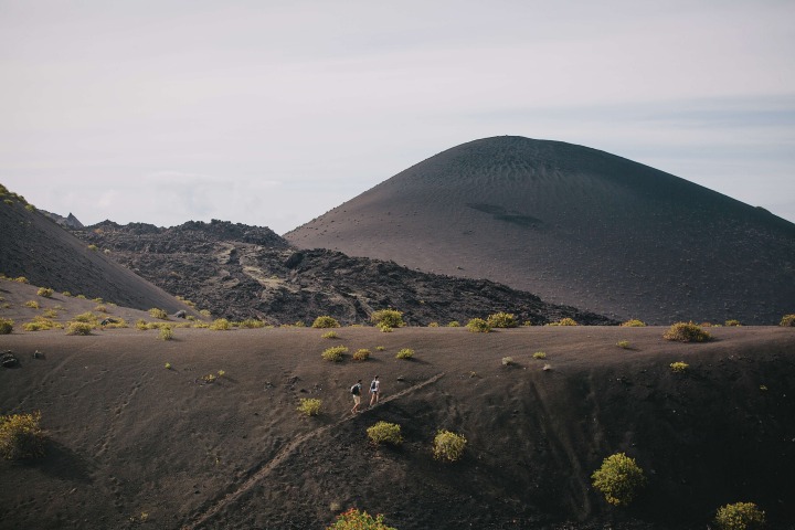
2. VOLCÁN DE LA CORONA
We continue our route around the island, climbing volcanoes, and also increasing the difficulty of the route. It is the “Volcán de La Corona” route, one of the most impressive hiking routes in Lanzarote.
The starting point is the car park located in the church of the “Yé” village. The route is great fun, constantly changing scenery: through vineyards and fig trees, until you reach the clearer path, which marks the beginning of the ascent to the crater of “La Corona Volcano”.
History also precedes this hiking route in Lanzarote. The volcano, which once caused an eruption that covered a total of 18 km2 with lava, is more than 3,000 years old.
It is, as indicated, a hike with a higher level of difficulty, due to the steep slope on the way up to the crater. In fact, it should also be noted that the path narrows in the final stretch. Nevertheless, when you reach the summit, it is one of the most impressive landscapes on the island. The way back is marked by the same path.

3. HARÍA - EL BOSQUECILLO
We change the scenery and leave the volcanoes to walk through landscapes with vegetation. We go to “Haría - El Bosquecillo”, a different kind of hiking route in Lanzarote.
The start of the route is located in the town of Haría, about 200 metres from its historic centre. On the way to “El Bosquecillo”, the route crosses the “Valle del Paso” - or the Valley of the 1,000 palm trees - and also different crops.
It is a circular route that covers just over 12 kilometres, some of which are steep. It is therefore another of the most difficult hiking routes in Lanzarote.
From the “El Bosquecillo” viewpoint, you can see another of the highest points on the island: Famara, at around 500 metres. Along the route, you will also find the “Montaña Ganada” viewpoint, another of the island's key spots, from where you can enjoy the scenery.
4. MONTAÑA ROJA
We return to the volcanic landscape, and we also lower the difficulty. “Montaña Roja” is one of the easiest hiking routes in Lanzarote, it runs through the south point of the island, “Playa Blanca”.
The route starts in “Claveles” and, from there, you just have to follow the path, crossing the beaches of Papagayo or the area of “Faro Pechiguera”, until you reach the crater of the volcano, one of the most impressive spots in this part of the island. You can even go down to see it, it is a spectacle of colours and perspectives, as well as supernatural stories and legends.
5. FROM “EL LITORAL” TO “EL GOLFO”
We conclude the hiking routes in Lanzarote with this route: the Litoral route, which runs through the same enclave as our first route: the Timanfaya National Park.
The trail starts in the village of “El Golfo”, a pretty fishing village. At the beginning of the trail, you can find one of the most impressive beaches on the island, the “Charco de los Clicos” beach, with black sand.
It is a 7-kilometre walk of low difficulty, but with a special charm: marked by the volcanic landscape and steep cliffs. The route ends at “Playa del Paso”, the ideal place to enjoy a beautiful sunset on the island.

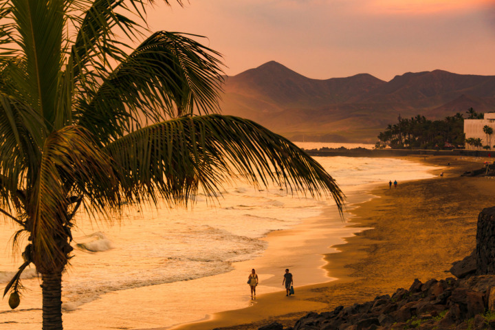
WHERE TO STAY: ACCOMMODATION IN LANZAROTE
Seaside Los Jameos invites you to discover the most impressive hiking routes in Lanzarote. Just bring with you: comfortable clothes, suitable footwear, sunglasses, and sun protection: the whole trekking kit, and we will take care of your rest and recovery at the hotel.